Membership renewals open for 2024 - Click here

WA

ASEG WA - Student Tech Night

Friday, November 27, 2020
1730
1900

The WA Branch of the Australian Society of Exploration Geophysicists is excited to invite you to our first person-to-person live ASEG WA Tech Night since March!
We are hosting our upcoming 2020 Student Tech Night presented by WA Honours, Masters or PhD Students from UWA and Curtin.

Three or four students will present their recent work in the field of geophysics at this annual student night. Attendees will be asked to vote on the best presentation, and one student will be awarded a prize courtesy of the WA branch.
Be assured that the Celtic Club is honouring all current Covid restrictions and chairs will be spaced for social distancing. We therefore will have to limit attendance, so first come first served!
 
Mahtab Rashidifard (UWA)
Sofya Popik (Curtin)
Partha Pratim Mandal (Curtin)
TBA

Please rsvp in the below link to get a spot as seats are limited. We are looking forward to see you there.

Register Here!

ASEG WA Webinar: Pre-stack Depth Imaging: Challenges in exploration-scale volcanic geobody model-building in the Potiguar Basin, Brazil

Tuesday, November 10, 2020
1500 (AWST)
1600 (AWST)

Pre-stack Depth Imaging: Challenges in exploration-scale volcanic geobody model-building in the Potiguar Basin, Brazil

Rich Bartlett, Shearwater GeoServices

Register here: https://us02web.zoom.us/webinar/register/WN_PRBuo4cySDixmFf5QwTLMQ

The Potiguar Basin includes the largest oil-producing region in Equatorial Brazil, where production is from the syn-rift to transitional successions. The Pitu well in the deep-water offshore part of the basin found oil, gas and condensate at depths of 4,300m in Upper Aptian sands of the Alagamar and Pescada Formations.


A 10,500 km² 3D survey was acquired in 2019 and seismic processing through PSDM imaging was initiated. The presence of high velocity volcanics in the sedimentary sequence presents unique imaging challenges for Pre-Stack Depth Migration (PSDM). By their nature, volcanic geobodies have a varying thickness, velocity fill and extent, and require detailed interpretation to be represented accurately in a PSDM anisotropic model. This talk will present an iterative and efficient methodology to interpret and refine volcanic geobodies with examples from this exploration-scale PSDM survey.


Rich Bartlett, Depth Imaging Manager from Shearwater GeoServices. Rich graduated in 2002 from the University of Leeds UK and Queen's University Canada with a Masters In Geophysics. He spent his early career as a Geophysicist at Veritas DGC with various roles in the Depth Imaging teams in both London and Calgary offices, moving through the various incarnations of CGGVeritas and CGG. This was followed by 3 years consulting with Monarch Geophysical Services on a range of marine and land acquisition and processing projects before moving back to the frontline with Dolphin Geophysical in 2013, and latterly with Shearwater GeoServices. Rich has helped build Shearwater's Depth Imaging capabilities from scratch, with Shearwater now offering a wide range of inversion and imaging services behind its vessels and to the open proprietary market.


Webinar: Grayscale representative elementary volumes: An innovative approach to investigate pore-scale REVs from raw micro-CT images

Thursday, October 1, 2020
1200 (AWST)
1300 (AWST)

Title and Summary:

Grayscale representative elementary volumes: An innovative approach to investigate pore-scale REVs from raw micro-CT images

Representative Elementary Volumes (REVs) are at the foundation of measuring rock properties that capture local heterogeneities of the rock structure at a particular length-scale for upscaling purposes. High-resolution micro-computed tomography (micro-CT) images of rocks have allowed a full 3D characterization of rock structures at pore-scale. These micro-CT images store information about rock structure as variations in the gray-level intensities or CT numbers. However, the direct use of these information-rich raw micro-CT images for rock characterization has not been possible due to a limited number of rock properties that can be calculated from them. In this study, we implement a novel texture characterization technique called the Gray-level Size Zone Matrix (GLSZM) to analyze the raw micro-CT images. We apply the GLSZM approach to homogeneous and heterogeneous sandstones and carbonates and show that this method highlights important rock features such as mineralogical heterogeneities and sub-resolution porosity. Considering these features, we calculate GLSZM statistics, that serve as proxies to porosity and permeability, which are crucial petrophysical properties. Comparing the trends of these proxies to petrophysical properties at various scales and spatial locations of the rock sample, we then infer Grayscale REVs (GREVs) and validate it using existing literature. Finally, we show that using the GLSZM-based approach, we can infer GREVs in a robust, reproducible, and fast manner. These GREVs can then serve as a priori for further petrophysical characterization of rock samples. 

Bio:

Ankita Singh is a Ph.D. student at the School of Minerals and Energy Resources Engineering at UNSW, Sydney. Her work focusses on implementing texture analysis techniques for rock characterization by directly using raw x-ray images. Her Ph.D. work has been published in reputed journals such as Water Resources Research and Geophysical Research Letters. She also won the 'Best Engineering/Environmental Student Paper' at AEGC 2019 in Perth and was the 2019 Finalist at the UNSW Three Minute Thesis Competition. 

Register now: https://us02web.zoom.us/webinar/register/WN_gYxzak7oQ_y6-AE_JwdXEQ


Geoscience Society/AGC – Webinar: Iron-Oxide Copper-Gold (IOCG) Deposits: Definition, Nature, Tectonic Setting and Magmatic-Hydrothermal Origin

Tuesday, August 11, 2020
1700 (AWST)
1800 (AWST)

Geoscience Society/AGC – Webinar: Iron-Oxide Copper-Gold (IOCG) Deposits: Definition, Nature, Tectonic Setting and Magmatic-Hydrothermal Origin

Participants will gain an insight into the iron oxide-copper-gold (IOCG) group of deposits, discussing the temporal distribution and tectonic environments of the various subtypes.

Date: Tuesday 11th August 2020

Time: 5.00 pm – 6.00 pm AWST

Presenter: Professor David I Groves – Recipient of AGC’s National Geoscience Champion Award in 2018

Cost:

AusIMM Member – Free

Member of an AGC Member Society (AIG, GSA, ASEG etc.) – Free

Non Member – $20.00

To register, go to this link


Digital Tech Talk Overview

This talk has a closer look at iron oxide-copper-gold (IOCG) group of deposits, discussing the temporal distribution and tectonic environments of the various subtypes. The sub-classes include low-Ti iron oxide-associated deposits that include iron oxide (P), iron oxide (F, REE), skarn Fe or Cu-Au and high-grade Au ± Cu.

It appears most likely that formation and preservation of giant IOCG deposits was largely a Precambrian phenomenon related to heightened activity of mantle plumes that impacted on buoyant  metasomatized SCLM at that stage in Earth history, with Phanerozoic IOCG deposits forming only rarely in tectonic settings where conditions similar to those in the Precambrian were replicated.

Presenter Bio

David Groves was born in Brighton, England, and migrated to Tasmania where he was educated at Hobart High School and at the University of Tasmania, completing a PhD on the giant Mt Bischoff tin deposit under the mentorship of Mike Solomon. After a period with the Geological Survey of Tasmania, where he learned mapping and field skills, David was appointed Lecturer in Economic Geology at the University of Western Australia (UWA) in 1972. In 1987, he was awarded a Personal Chair at UWA and formed the Centre for Strategic Mineral Deposits, which morphed into the Centre for Global Metallogeny, with him as Director, and which became the Centre for Exploration Targeting after his retirement as Emeritus Professor. He had a very successful academic career in terms of approximately 500 highly-cited published papers and book chapters, many keynote and invited lectures, and mentorship of many outstanding postgraduates, being awarded 12 medals and prizes, including the SEG Silver and Penrose Gold Medals and the SGA-Newmont Gold Medal, and being inducted into the Australian Academy of Sciences as a Fellow. He has been President of GSA, SEG and SGA during his career and represented Australia on UNESCO committees.

Helitem: New Technology in Airborne TEM for Deep and Covered Targets with Western Australia Examples

Thursday, August 20, 2020
1200 (AWST)
1300 (AWST)

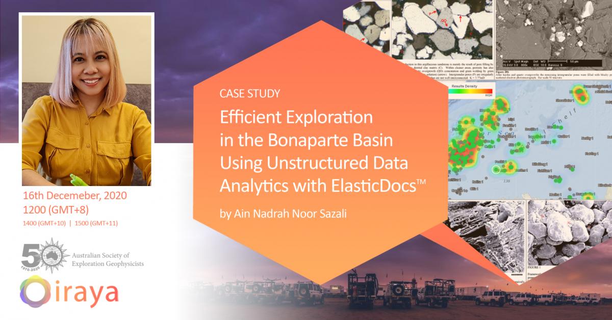
Helitem2: New Technology in Airborne TEM for Deep and Covered Targets with Western Australia Examples

Adam Smiarowski, Chief Geophysicist at CGG

Date & Time: 20thAugust 2020; 12 – 1PM AWST

Please register here https://us02web.zoom.us/webinar/register/WN_x4nG-nqoRiqRmsGyXj485g

Abstract:

Exploration for targets at depth or targets obscured by conductive overburden have historically been a challenge with airborne EM methods. Although modern systems have been improved with greater primary transmitter moments, noise levels from receiver coil motion in the Earth’s ambient field has limited the detection of secondary target signals, especially at late times, and has limited the use of lower base frequencies. The new Helitem² system uses a patented low-noise receiver, a 50% duty cycle square pulse transmitter waveform, and low Tx base frequency, to achieve increased signal detectability for deep and covered targets.

Modeling and a series of demonstration surveys compared several helicopter-borne time-domain system configurations, including high-moment halfsine waveforms and low base frequency (15 Hz and 7.5 Hz)  50% duty cycle square waveforms.

Using a thin-plate, modelling showed that a low base frequency square pulse will have a significantly larger response than a half sine pulse at standard 30 Hz base frequency for a wide range of target conductances. At early times, the sharper (quicker) turn off of the square wave results in much more high-frequency energy, and therefore better signal, for weakly conductive targets, and better near-surface resolution. At the other extreme, the response from very conductive targets is determined by the area under the transmitter curve, so the low frequency square waves with 16 and 33 ms widths produces more than twice the signal as the half sine.

Demonstration survey line profiles and decay curves over the target and background locations confirmed this modelling for a 400 m deep target and variable overburden. The combination of pulse width, power, and low noise enabled the Helitem2 system to be effective at low base frequencies, where very late time data is beneficial for detecting strong and deep targets. The survey demonstrated that the redesigned Rx suspension system was able to reduce coil motion noise, enabling acquisition of high quality low base frequency data useful for detection of deep targets to very late times. The wide-pulse waveform was effective at energizing a moderately-conductive target, increasing signal level by a factor of 2 above a 6 ms pulse. This will be even more beneficial when exploring for strong conductive targets at depth. Prior to this Rx re-design, noise levels at low base frequencies was too high, and the data was not useful for target detection.

Examples from Western Australian are provided, illustrating data improvements of Helitem2 operating at 12.5Hz, over a previous survey at 25Hz.

Biography:

Adam has been involved with electrical methods for environmental and exploration applications for 15 years. Adam completed an MSc in Geophysics at RMIT University and PhD in Physics and Geology at the University of Toronto.  He has been involved with airborne EM research, both in frequency and time-domain, with CGG MultiPhysics for the past 9 years. has worked on applications related to reservoir modeling, seismic inversion and machine learning. 

WA tech night - nd-to-end seismic inversion of geostatistically complex reservoir facies models with deep convolutional neural networks

Thursday, August 6, 2020
1200 AWST
1300 AWST

Title: End-to-end seismic inversion of geostatistically complex reservoir facies models with deep convolutional neural networks

Anshuman Pradhan, Stanford University

Date & Time: 6th August 2020; 12 – 1PM AWST

https://us02web.zoom.us/webinar/register/WN_-3DqbXyKRuuQL88cngGFBg

Summary:

We present a framework for performing end-to-end seismic inversion of reservoir facies models under complex geostatistical models of prior uncertainty. In our methodology, we directly learn the end-to-end inverse mapping between 3D seismic data and reservoir facies using deep 3D convolutional neural networks. Our training dataset is simulated from the forward generative model comprising of the geostatistical prior on facies and geophysical model relating seismic to facies through elastic properties. To ensure reliability during prediction with real data, a method for performing data-based falsification of prior uncertainty is presented. Using a real case study from an offshore deltaic reservoir, we demonstrate the efficacy of our approach by inverting a large-scale facies model from 3D post and partial stack seismic data.


Biography:

Anshuman Pradhan is a PhD candidate in the department of Energy Resources Engineering at Stanford University. He is a research assistant associated with the Stanford Center for Earth Resources Forecasting, Stanford Rock Physics and Borehole Geophysics project and the Stanford Basin and Petroleum System Modeling consortia. Anshuman obtained his M.S. and B.S. degrees in Applied Geophysics from Indian Institute of Technology (Indian School of Mines), Dhanbad, India. Anshuman has several industry and academic internship experiences where he has worked on applications related to reservoir modeling, seismic inversion and machine learning. 

Contemporary crustal stress pattern of Australia

Thursday, July 23, 2020
1200 (AWST)
1300 (AWST)

Title: Contemporary crustal stress pattern of Australia


Summary:

The present-day stress field of Australia has been the subject of great interest in the three past decades because it shows a variable pattern for the orientation of maximum horizontal stress (SHmax) that is not parallel to absolute plate motion. Analysis of in-situ stress data across Australia (in >20 sedimentary basins) reveals four major trends for the orientation of SHmax including NE-SW in northern, northwestern and northeastern Australia, E-W in southern half of Western Australia and South Australia, ENE-WSW in most parts of eastern Australia and NW-SE in southeastern Australia. In addition, the results reveal significant rotation of stress within various sedimentary basins due to the presence of different geological structures, including basement structures, faults, fractures and lithological contrasts. Understanding and predicting local stress perturbations has major implications for determining the most productive fractures in petroleum and geothermal systems, and for modelling the propagation direction and vertical height growth of induced hydraulic fractures in unconventional reservoirs.

Biography of the presenter:

Dr Mojtaba Rajabi is an ARC DECRA Fellow at the School of Earth and Environmental Sciences, University of Queensland. He has over 12 years of extensive experience in crustal stress analysis, reservoir geomechanics, geomechanical-numerical modelling and petrophysics. He graduated with a Ph.D. in Earth Sciences from the University of Adelaide in 2017. Dr Rajabi has worked on the geomechanical analyses of >30 sedimentary basins from across the world including Australia, New Zealand, Middle East, Mozambique, Iceland and Western Mediterranean. Since 2012, Dr Rajabi has worked on the Australian and World Stress Map projects. He has received >15 international awards and prizes for his research including the ARC-DECRA Award, the Australian SEG Early Achievement Award, EAGE Louis Cagniard Award, and the International Lithosphere Program’s Flinn-Hart Award.

Ten years in the wild (Redux)

Tuesday, July 7, 2020
1600 (AEST)
1700 (AEST)

The ASEG welcome you to join us on ZOOM on Tuesday 7 July, 4pm (AEST) for a talk by David Annetts from CSIRO.


Ten years in the wild (Redux)

An updated and expanded version of the AEGC presentation providing background to a CSIRO project that was placed in the public domain in 2009.  The talk offers lessons and guidance for others who would walk a similar path.

The use of open-source codes has become pervasive over the past 20 years but such codes are uncommon in minerals exploration. The P223 series of programs researching forward and inverse modelling of electromagnetic data was supported by CSIRO and six AMIRA consortia over 27 years and produced, amongst others, the codes, Airbeo, LeroiAir and Marco. This project concluded in 2008 and, after a two-year embargo, the code base, consisting of computer programs modelling different approximations of the earth for ground and airborne prospecting systems, was released to the public. We discuss reasons why codes have not been more widely adopted, and examine the evolution of some of the codes in research, academia and in industry as a guide to parties who would embark on a similar route.

David Annetts has been with CSIRO since 2007. A forward-modeller by inclination, he has researched the application of frequency and time-domain electromagnetic prospecting methods to marine CSEM, CO2 sequestration, uranium and groundwater exploration, and maintains an active interest in CSIRO’s Bayesian Lithological Inversion initiative.  He is also the current ASEG President.

Register Now: https://us02web.zoom.us/webinar/register/WN_wRoI_iXERlmmAA-wtXjHLw


After registering, you will receive a confirmation email containing information about joining the webinar.

ASEG Webinar: Seismic Attribute Illumination of complex fault network North Slope, Alaska

Thursday, June 25, 2020
12:00 (AEST)
13:00 (AEST)

Please join us on Thursday 25th June, 12:00pm (AEST) for a talk by Sumit Verma from University of Texas of Permian Basin (UTPB).


Seismic Attribute Illumination of complex fault network North Slope, Alaska

The North Slope, Alaska has a complex fault system in the subsurface due to different episodes of tectonics. The most producing reservoirs are fault controlled. Our study area lies in the south of the well-known Prudhoe Bay and Kuparuk River oil fields. The Triassic-aged Shublik Shale, which is the most prominent source rock, has gone through three stages of extensional tectonic activities during the Jurassic, Cretaceous, and Eocene. To understand the complex fault system, we computed an ensemble of volumetric seismic attributes, including coherence, curvature and aberrancy, and studied them along the Shublik Shale surface. In this study, we have divided the structures into three types based on seismic signature, 1. significant fault throw on vertical seismic section, 2. insignificant fault throw but clearly visible flexure, 3. insignificant fault throw and very weak flexure. We observed type 1 faults on the vertical seismic section, and seismic attributes which trends in WNW direction, these faults have large lateral extent. The type 2 faults have similar orientation as type 1. The type 2 faults are clearly visible on the curvature and aberrancy attributes. Although, the type 3 structures have no visible throw on vertical seismic, but, it can be seen as two fault lineation (which are orthogonal each other) on curvature and aberrancy attributes. Based on our attribute analysis and regional geologic understanding, we believe that, the type 1 and type 2 fault sets are of Jurassic age, whereas the two faults of the type 3 were formed in Cretaceous and Eocene with an orientation of nearly east-west and north-south orientation. These type 1 faults display cross cutting, single-tip and double-tip abutting relations with the older west-north-west striking faults.


Biography:

Dr. Sumit Verma is an Assistant Professor of Geophysics at UTPB. Dr. Verma received his M.S. (2007) in Applied Geophysics from the Indian School of Mines - Dhanbad, and his Ph.D. (2015) in Geophysics from the University of Oklahoma. After earning his PhD, he worked for one year as a Postdoctoral Research Fellow at the University of Wyoming. Dr. Verma also worked with Reliance Industries Ltd. E&P for four years (2007-2011) as a development geoscientist. Dr. Verma’s research areas are Seismic Interpretation, Quantitative Interpretation and Reservoir Characterization. Dr. Verma is a deputy editor for the peer-reviewed scientific journal: Interpretation.


Register Now: https://us02web.zoom.us/webinar/register/WN_Myhly7WKS6uTu0wS9bldQw


After registering, you will receive a confirmation email containing information about joining the webinar. Contact secretary@aseg.org.au if you have any questions.  


Please bring your own drinks and nibbles.

ASEG Webinar: Probabilistic Seismic Full Waveform Inversion (FWI)

Thursday, June 11, 2020
1400 (AEST)
1500 (AEST)

Please join us on Thursday 11th June, 2:00pm (AEST) for a talk by Anandaroop Ray


Probabilistic Seismic Full Waveform Inversion (FWI)


Register Now: https://us02web.zoom.us/webinar/register/WN_MBfv_1tRSeuLMq-7PvKI_Q


After registering, you will receive a confirmation email containing information about joining the webinar. Contact secretary@aseg.org.au if you have any questions.  


Please bring your own drinks and nibbles.


Probabilistic Seismic Full Waveform Inversion (FWI)

Limited illumination, insufficient offset, noisy data and poor starting models can pose challenges for seismic full waveform inversion (FWI). Appropriately formulated Bayesian approaches can mitigate these problems by appealing to parsimony, i.e., low model dimension, and through rigorous quantification of prior knowledge. Given the flexibility of the Bayesian framework, the theory can include the inference of nuisance parameters such as the source wavelet and data noise. Given the tandem developments in statistical inference and HPC, sampling based approaches to FWI are able to provide a surprising amount of subsurface information. While the non-linearity of wave physics is indeed a significant obstacle for inversion algorithms, it is also the reason why inferences, should we reach the appropriate local minima (or posterior probability maxima), are so much more informative than for diffusive or potential field geophysics. Through a combination of synthetic and real data examples, this talk will attempt to encourage further research in this arena.

Biography:

Anandaroop Ray (“Anand”) started his career as a non-seismic geophysicist with Shell Exploration and Production in 2007. In 2010 he joined the PhD programme in marine electromagnetics at the Scripps Institution of Oceanography in San Diego, California. In 2014 he completed his thesis focusing on uncertainty estimation in electromagnetic inversion for marine hydrocarbon exploration. From 2012-19, he worked for Chevron R&D on various problems – controlled source electromagnetics (CSEM), seismic full waveform inversion (FWI), reservoir properties from seismic (RPFS), airborne electromagnetics (AEM), statistical hydrocarbon exploration lookback analyses, and the role of machine learning in geophysics. The question most asked through his work is “how credibly can we interpret our inversion model(s),” the answering of which often requires the use of high performance computing (HPC) techniques. He currently co-advises a PhD student at Columbia University on Bayesian geophysical inversion, and has been active in convening and organizing the Uncertainty in Geophysical Inversion session at the American Geophysical Union’s Fall Meeting. In March 2019 he joined the Minerals, Energy and Groundwater Division at Geoscience Australia, where he continues to work on inverse uncertainty, model representation and geostatistics.


Pages