 Please rsvp before 11th March 2020 to attend Joint Tech Nights organised by ASEG WA branch. The link for registration:
https://www.eventbrite.com.au/e/march-2020-joint-tech-night-tickets-97449440901
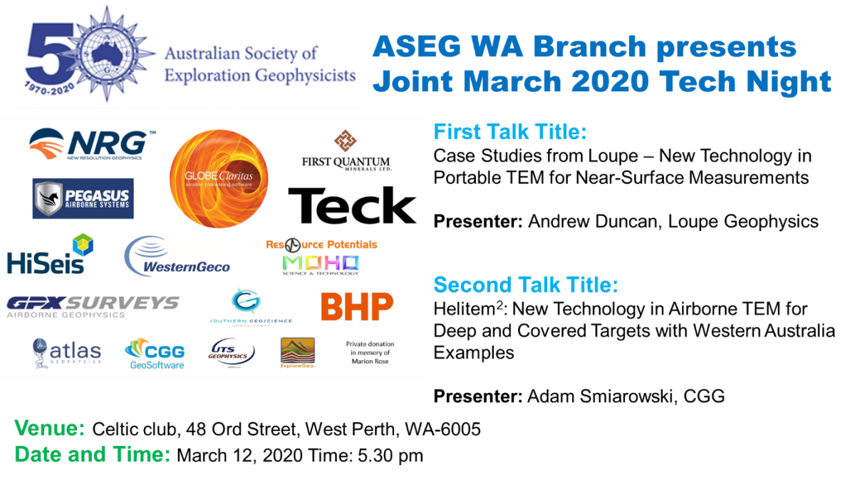
Direction to the venue: Celtic club
First Technical Talk: Case Studies from Loupe – New Technology in Portable TEM for Near-Surface Measurements
Presenter: Andrew Duncan, Loupe Geophysics
Abstract:
A portable, broadband TEM system, Loupe, has been developed for the purpose of measuring near-surface electrical conductivity. The system records continuously while walking using a three-component coil receiver mounted on an ergonomic backpack from signals generated by a small (660mm) diameter, multi-turn transmitter loop mounted on a similar backpack.
The Loupe system is designed primarily to measure electrical conductivity in the top 25 metres, previously the charter of frequency-domain EM systems. Using modern electronics and software, combined with full time-series measurement, we have been able to overcome the interference and calibration issues around measuring near surface conductivity with a broad bandwidth time-domain system. Sampling at around a half million samples per second and processed to produce a measurement of secondary TEM field every second, the Loupe system provides very high spatial resolution. Data can be viewed as the operators walk, allowing survey redesign as necessary.
During 2019, trial surveys were conducted with Loupe in a number of near-surface applications including mineral exploration on surface and underground, geological / regolith mapping, study of groundwater around tailings storage facilities and the mapping of structural features in open-cut mines. We see a wide application for Loupe in mapping seepage both from mine tailings and acid mine drainage.
Loupe has proved to be quite versatile, working in difficult terrain and areas with high electromagnetic interference such as mine sites and urban sites. Special challenges are presented when working on these sites due to power reticulation, vehicle movement and infrastructure. We will give examples showing data collected in these environments.
During this presentation, we will summarise the Loupe system and show results from several recent surveys.
Bio:
Andrew Duncan is the Managing Director of ElectroMagnetic Imaging Technology Pty Ltd (EMIT), based in Perth, WA. EMIT, which recently celebrated 25 years in business, has developed technology including the SMARTem electrical methods receiver system, Maxwell EM software and the DigiAtlantis borehole magnetometer system for EM. Andrew has a background in the development of technology for electrical geophysics including the development of airborne EM systems and distributed systems for geophysical measurements. Recently, he founded Loupe Geophysics with Greg Street, in order to develop and commercialise a novel, portable TEM system called Loupe. Andrew has interests in signal processing, EM techniques for highly conductive targets and modelling of EM data.
Second Technical Talk: Helitem2: New Technology in Airborne TEM for Deep and Covered Targets with Western Australia Examples
Presenter: Adam Smiarowski, CGG
Abstract:
Exploration for targets at depth or targets obscured by conductive overburden have historically been a challenge with airborne EM methods. Although modern systems have been improved with greater primary transmitter moments, noise levels from receiver coil motion in the Earth’s ambient field has limited the detection of secondary target signals, especially at late times, and has limited the use of lower base frequencies. The new Helitem² system uses a patented low-noise receiver, a 50% duty cycle square pulse transmitter waveform, and low Tx base frequency, to achieve increased signal detectability for deep and covered targets.
Modeling and a series of demonstration surveys compared several helicopter-borne time-domain system configurations, including high-moment halfsine waveforms and low base frequency (15 Hz and 7.5 Hz) 50% duty cycle square waveforms. Using a thin-plate, modelling showed that a low base frequency square pulse will have a significantly larger response than a half sine pulse at standard 30 Hz base frequency for a wide range of target conductances. At early times, the sharper (quicker) turn off of the square wave results in much more high-frequency energy, and therefore better signal, for weakly conductive targets, and better near-surface resolution. At the other extreme, the response from very conductive targets is determined by the area under the transmitter curve, so the low frequency square waves with 16 and 33 ms widths produces more than twice the signal as the half sine.
Demonstration survey line profiles and decay curves over the target and background locations confirmed this modelling for a 400 m deep target and variable overburden. The combination of pulse width, power, and low noise enabled the Helitem2 system to be effective at low base frequencies, where very late time data is beneficial for detecting strong and deep targets. The survey demonstrated that the redesigned Rx suspension system was able to reduce coil motion noise, enabling acquisition of high quality low base frequency data useful for detection of deep targets to very late times. The wide-pulse waveform was effective at energizing a moderately-conductive target, increasing signal level by a factor of 2 above a 6 ms pulse. This will be even more beneficial when exploring for strong conductive targets at depth. Prior to this Rx re-design, noise levels at low base frequencies was too high, and the data was not useful for target detection.
Examples from Western Australian are provided, illustrating data improvements of Helitem2 operating at 12.5Hz, over a previous survey at 25Hz.
Bio:
Adam has been involved with electrical methods for environmental and exploration applications for 15 years. Adam completed an MSc in Geophysics at RMIT University and PhD in Physics and Geology at the University of Toronto. He has been involved with airborne EM research, both in frequency and time-domain, with CGG MultiPhysics for the past 9 years.