Membership renewals open for 2024 - Click here

Industry

The 19th International Symposium on Deep Seismic Profiling of the Continents and their Margins - SEISMIX 2020

Sunday, March 15, 2020
0800
1900

The 19th  International Symposium on Deep Seismic Profiling of the Continents and their Margins - SEISMIX 2020

http://seismix2020.org.au/

On behalf of Curtin University, Perth, we would like to invite you to participate in the 19th edition of the biennial International Symposium on Deep Seismic Profiling of the Continents and their Margins (SEISMIX 2020) that is now also extended to include the latest technological and scientific developments in the application of seismic methods. This high profile conference has been held in many countries it is our pleasure to welcome delegates to Fremantle W.A.

The Symposium will be held at the Esplanade Hotel in Fremantle, near Perth, Western Australia, from Sunday 15th of March to Friday 19th of March 2020.

A field trip is also planned to take place after the Symposium. It will run for seven to eight days and take in a wide range of Western Australia’s pristine coastlines and interior.

Symposium registrations and abstract submissions are now open:

  1. Register here for the Symposium
  2. Submit your abstract here


WA Tech Night - PSDM in relatively benign on-shore settings

Wednesday, November 13, 2019
1730
1900

Date = Wednesday 13 November

Time = 530 to 7pm

Venue = Celtic Club, West Perth WA

Title = PSDM in relatively benign on-shore settings

Speaker = Marianne Rauch, TGS


Abstract:

Off-shore, depth imaging has been performed for a long time, especially to improve imaging around salt domes and faults. However, conventional wisdom dictates that in geological benign areas, it is not necessary to pre-stack depth migrate the data and stretching from time to depth is enough. A majority of the unconventional reservoirs are in geological less complex areas and this argument could be valid. We are presenting our thoughts why this is not correct and why applying a well-executed PSDM is worth the effort.


In many on-shore unconventional basins worldwide, the general geology around the tight reservoirs is nearly flat but the velocity and anisotropy within these layers can change rapidly laterally. PSTM velocities are based on hyperbolic assumptions and the ability to accurately image these changes are limited. In addition, it is crucial to solve the velocities in the near surface for accurate ray tracing but nearly impossible to do in the time domain. These issues can produce incorrect depthing and lateral positioning of the seismic events. A well-performed PSDM will result in an amplitude preserved dataset that has a higher resolution and can be used for geo-steering and attribute calculation which will further enhance the knowledge of the reservoir space. 


Speaker Bio:

Marianne received her PhD in Physics in 1985 from Uni Graz in Austria. She started her oil career as research assistant at Curtin University in Perth, Australia 30 years ago and has been active in geophysics ever since then. Marianne lived in many places and worked on-shore and off-shore basins all over the world. Her main specialties are DHI, seismic processing, depth migration, potential fields and researching new technologies, methodologies. She likes to do applied research, mentor and teach and is a seasoned presenter at conventions and workshop. She has published a good number of articles on several subjects and still is passionate about geoscience and the thrill to get more and unique information out of geophysical measurements that help drilling more successful wells. Currently, she is the Principal Technical Advisor, multi-client, onshore, TGS, Houston.

TAS Tech talk - The development and implementation of drones for magnetic surveys

Wednesday, October 16, 2019
1200
1400

Dear ASEG Tasmania members and potential members,

Come and hear about Anton Rada’s work at the forefront of the development and implementation of drones for magnetic surveys.  Noon in the CODES Conference Room (UTas Sandy Bay campus), Wednesday 16th October.   Please let branch president Mark Duffett or branch secretary Matt Cracknell know if you’d like to join the speaker and Mark Duffett for lunch at the Uni Staff Club after the talk.

Vic Tech Night - A new Full Spectrum FALCONⓇ airborne gravity and aeromagnetic survey over the Otway Basin, Victoria

Tuesday, October 1, 2019
1800
1930

Dr Mark McLean, Geological Survey of Victoria presents a talk titled A new Full Spectrum FALCONⓇ airborne gravity and aeromagnetic survey over the Otway Basin, Victoria.

Tickets here

Our next meeting will be a joint event with the Young Professional Group and will happen on the 1st of October 2019. As usual it will be held at the Kelvin Club from 6 pm onward.

We will have the pleasure to welcome Dr Mark McLean from the Geological Survey of Victoria with a presentation about the Falcon survey that was acquired recently in the Otway Basin.

Please register before the 30/09/2019 noon time using the Eventbrite link.

In case of dietary requirement please email directly to vicpresident@aseg.org.au.

Abstract

Seismic surveying has been demonstrated to be the most effective technique to image sub-surface geological structure, particularly within sedimentary basins characterised by sub-horizontal stratigraphy where seismic energy is readily reflected back to the surface. However, there are some examples where seismic acquisition does not provide the most effective results: 1) where the area of interest lies along the coastal transition zone making acquisition problematic, 2) where there are sub-vertical geological structures (such as faults) which cause the seismic energy to be reflected away from the sensors and 3) where volcanic rocks attenuate the seismic signal.

Airborne Gravity Gradiometry (AGG) is a technique which measures very small changes in Earth’s acceleration. This approach is appropriate for the Otway Basin particularly in the transition zone where the geology is poorly understood. Qualitative interpretations can be made in map view, but data can also be quantitatively modelled using forward and inversion modelling processes. This approach makes airborne gravity gradiometry a complementary dataset for most of the seismic in the Otway which is dominated by 2D lines. Therefore, airborne methods provide an opportunity to not only ‘fill in the gap’ along the coast between seismic data collected off-shore and onshore, but there is also potential to add further detail to horizon geometries in between the more widely spaced (3-4km) seismic lines.

A new airborne Full Spectrum Gravity and magnetic survey has been undertaken as part of the Victorian Gas Program (VGP) using CGG’s FALCON® airborne data acquisition system. Flying commenced in August 2018 and was completed by early January 2019 (12 weeks). A total of 31042 line km of gravity, gravity gradiometry (Full Spectrum), magnetic and laser scanner data were acquired along 500 m spaced lines in a NW-SE orientation and 15000 m perpendicular tie lines. The surveyed region includes approximately 16000 km2 of the Otway Basin in Victoria, stretching from the edge of the Otway Ranges to the South Australian border, and from south of the Grampians to approximately 18 km offshore. Data were acquired at an altitude of 150 metres, increasing to 300 metres over built-up areas. A single engine Cessna Grand Caravan 208B was used to conduct the onshore portion of the survey and a DHC-6-100 (Twin Otter) aircraft was used for the offshore component. The survey has resulted in the largest airborne gravity dataset ever collected in Victoria and provides superior quality gravity imagery, compared with pre-existing data.

This presentation will visit a range of topics including the initial rationale for the survey, survey design, instrumentation and acquisition, but some emphasis will be placed on the new Full Spectrum product now being offered by CGG. This survey is the first publicly available Full Spectrum Falcon survey and is intended to capture the full spectrum of wavelengths by conforming the short wavelengths from the gravity gradiometry, with the longer wavelengths obtained from concurrently acquired conventional gravity.

Bio

Mark completed Arts/Science and Master of Science degrees at Monash University and then completed a PhD at The University of Melbourne in 2008 which involved acquisition, interpretation and modelling of an airborne geophysical survey over the Lambert Rift region in East Antarctica. Since then, Mark has worked at the Geological Survey of Victoria building regional 3D framework and rock property models using geological and geophysical datasets. Mark's time is now split between the GSV, and The University of Melbourne where he lectures in Applied Geophysics.


NT Tech talk - Synchronous natural climate cycles of the Common Era, for Europe, China and globally – existence and implications for future temperature trends

Thursday, October 17, 2019
1600
1700

The talk can also be streamed to other members, if interested please contact one of the NT Division committee members.


Title: Synchronous natural climate cycles of the Common Era, for Europe, China and globally – existence and implications for future temperature trends

Author: Professor Michael Asten, School of Earth Atmosphere and Environment, Monash University. The talk summarises a joint effort with Kuan-Hui Elaine Lin (Univ of Taiwan) Carl Otto Weiss (PTB Braunschweig, Germany) Nicola Scafetta (Univ of Naples, Italy) and Alison Kelsey (U Qld), developed over three years at EGU 2017, 2018 and 2019.


Bio: Michael Asten is a Professor (retired) and ongoing Adjunct Senior Research Fellow in the School of Earth Atmosphere and Environment, Monash University, Melbourne.  He is a past-President of the ASEG, and served a recent three-year term as the AGC representative on the Australian Academy of Sciences UNCOVER Committee.  He has published 190 scientific papers.  He has developed passive seismic (microtremor) methods for 15 years, developing applications for earthquake hazard, and regolith characterization.   In the past six years he has applied signal processing methods to paleoclimate data sets with a view to quantifying past climate cycles and equilibrium climate sensitivity


Abstract:

We compare proxy temperature cycles contained in   data sets from European glaciation, China agricultural records, and two global proxy constructions.  A high correlation between European and China data sets, especially for 800-2000 CE, demonstrates a level of synchronicity beyond possible regional phenomena.  Spectral analysis shows a series of spectral peaks in all data sets consistent with those detected globally in cosmic ray flux, which supports the theory of natural climate cycles being partially under astronomical control. An interesting sidelight from the European and China data is observed temporal coincidence of social phenomena such as population decrease, starvation, disease and wars during phases of cooling, compared with human advancement during historical warmer phases. When the observed natural cycles are built into climate models, part of the global temperature increase of the past 170 years may be accounted for by natural cycles; we explore how this may influence estimates of climate sensitivity (the warming attributable to CO2 forcing for a doubling of atmospheric CO2).


Please don't hesitate to contact one of the NT Division committee members should you have any questions or wish to remote in for either presentation.

NT Tech talk - Comparisons of large igneous provinces (LIPs) and black shales in North China and Northern Australian cratons: Implications for paleogeographic reconstruction, paleoenvironment and subdivision of the geological time scale

Friday, September 27, 2019
1600
1700

The talk can also be streamed to other members, if interested please contact one of the NT Division committee members.

Title: Comparisons of large igneous provinces (LIPs) and black shales in North China and Northern Australian cratons: Implications for paleogeographic reconstruction, paleoenvironment and subdivision of the geological time scale

Author: Prof Zhang Shuanhong, Institute of Geomechanics, Chinese Academy of Geology


Bio: Shuan-Hong Zhang is a Professor of the Institute of Geomechanics, Chinese Academy of Geological Sciences and vice-director of Key Laboratory of Paleomagnetism and Tectonic Reconstruction, Ministry of Natural Resources in Beijing. His recent researches mainly focus on Meso-Neoproterozoic tectonics and paleogeographic reconstructions of the Nuna (Columbia) and Rodinia supercontinents using large igneous provinces (LIPs) and rifting sediments, as well as the potential environmental effect of LIPs during the Meso-Neoproterozoic period. During last 5 years, he has published over 12 scientific papers in international journals such as Geology, Earth and Planetary Science Letters, Earth-Science Reviews, Precambrian Research, Tectonics, etc., and obtained two key research funds from the National Natural Science Foundation of China to study the Meso-Neoproterozoic tectonics and correlations of the LIPs and black shales during the "Boring Billon (1800 to 800 Ma).


Please don't hesitate to contact one of the NT Division committee members should you have any questions or wish to remote in for either presentation.

SA Tech Lunch - Which anomaly should I drill? Using spatial statistics to inform exploration in covered IOCG terranes.

Tuesday, October 8, 2019
1215
1330

Our next upcoming technical event, co-hosted with the Geological Survey of South Australia, is on Tuesday 8th October.

Laszlo Katona will be presenting, ‘Which anomaly should I drill?  Using spatial statistics to inform exploration in covered IOCG terranes.’

Attendance is free and lunch is provided but please RSVP via email for catering purposes.


Date/Time: 12:15 pm – 1:30 pm on Tuesday 8th October 2019

Venue: Rm 4.06, Level 4, ANZ building, 11 Waymouth St, Adelaide.

Cost: Free

RSVP: to sa-ntpresident@aseg.org.au or Kate.Robertson2@sa.gov.au. Please include any dietary requirements.


Hope to see you there!

WA Tech Night - What is that anomaly? Using machine learning to obtain geological knowledge from downhole petrophysical data

Wednesday, October 9, 2019
1730
1900
Date = Wednesday 9 October
Time = 530 to 7pm
Venue = Celtic Club, West Perth WA
Title = What is that anomaly? Using machine learning to obtain geological knowledge from downhole petrophysical data
Speaker = Mark Lindsay, Senior Research Fellow, CET, UWA


Abstract:

Machine learning encapsulates methods that enable computers to learn and act as humans, while continuously improving their learning over time in an autonomous manner. The process of continuous improvement is a key advantage of machine learning, and is achieved via access to larger datasets and information. Unsupervised machine learning methods are particularly adept at analysing large and diverse datasets to find commonalities between attributes and produce 'clusters', or groups of data points that share similar characteristics. These techniques appear adaptable for geoscientific data, with uptake by practitioners being high in recent years. A geophysical study of the Eastern Yilgarn, Yamarna region, was supported by analysis of drillcore using machine learning, and attempted to obtain more geological knowledge from the measured data. Five drill cores are analysed in the M476 Project; 12DHDD0001, 12DHDD0002, 15EIS001, 15SYDD0003B and 15SYDD0004. Analyses produced some expected associations between rocks and petrophysics (high density and basalt) while some unexpected associations were also obtained (conductivity and quartz). These and other results will be presented, and examples of how these can be used to support structural geophysical interpretation will be discussed. This work was supported by the Mineral Research Institute of Western Australia, the Geological Survey of Western Australia and Gold Road Resources.

Speaker Bio:

Mark Lindsay is a Senior Research Fellow at the Centre for Exploration Targeting, School of Earth Sciences, the University of Western Australia (UWA) and specialises in structural geophysical interpretation, integrated geoscientific and 3D modelling with an interest in understanding their interrelated uncertainties and the value-of-information. He also has research interests that include investigating complex systems and mineralisation. Machine learning and AI are also disciplines Mark attempts to use to answer geological questions. Mark is co-leader of the Automated 3D modelling model of the 'MinEx' Co-operative Research Centre, a science leader in the Loop 3D geological modelling consortium.

VIC Technical night: QGIS for Geoscience – Drill holes & more.

Wednesday, July 31, 2019
1800
2000

Registration: https://www.eventbrite.com.au/e/aseg-technical-night-qgis-for-geoscience-drill-holes-more-tickets-65611958133

Please join us on the 31st of July at 6 pm, at the Kelvin Club.

We will have the pleasure to listen to Roland Hill from MMG Ltd who will be presenting about: QGIS for Geoscience – Drill holes & more.

Please RSVP on Eventbrite by the 30/07/2019 noon.

Any dietary requirement please email directly to vicpresident@aseg.org.au

Abstract:

Earlier this year MMG's Group Manager for Innovation & Geophysics, Roland Hill, made a small but influential splash amongst the Geoscience community with the release of his QGIS plug-in. QGIS is an open-source, cross-platform Geographic Information System. It's small CPU footprint and low RAM requirements makes it well suited to academic and professional applications alike, while it's availability in 48 languages makes QGIS ubiquitous amongst geoscientists world-wide. In short, it's a useful, versatile piece of software which MMG, and many companies like it, use daily. And that is exactly what makes Roland's contribution so important – it’s extremely useful. His plug-in already extended the use of the standard package and with this update, Geoscience for QGIS v1.0, user functionality is extended even further to allow creation and display of drill hole sections

Bio:

Roland Hill is a geophysicist with 28 years’ experience exploring for gold, copper and zinc throughout Australia, Africa, SE Asia and South America. He is currently Group Manager Innovation & Geophysics for MMG based in Melbourne. An accomplished software developer, he specialises in integration of open source libraries for geospatial processing and visualisation.

SA/NT Tech Night - A Holistic Subduction/ Metasomatized Lithosphere Model for Orogenic Gold Deposits

Thursday, June 20, 2019
17:30
19:30

The ASEG SA/NT branch will meet on Thursday 20th June at 5:30 pm for a 6:15 pm start. 

We have Emeritus Professor David Groves speaking on, 'A Holistic Subduction/ Metasomatized Lithosphere Model for Orogenic Gold Deposits. '

David was recognised as a National Geoscience Champion by the Australian Geoscience Council in 2018, and we are honoured to have him present to us. 

https://www.agc.org.au/geoscience-in-australia/national-geoscience-champ...

Details:

Date and time: Thursday 20th June, 5:30 pm for 6:15 pm start

Cost: Free for ASEG members and students, $10 for non-members

Venue: Balcony Room, Hotel Richmond, 128 Rundle Mall, Adelaide, 5000

RSVP: Via Eventbrite (RSVP only, payment for non members to be paid in cash at the door)

https://www.eventbrite.com.au/e/national-geoscience-champion-emeritus-pr...

Hope to see you there!


Abstract

A holistic model for the origin of orogenic gold deposits and its implications for exploration

The term orogenic gold deposit has been widely accepted for the majority of gold-only lode-gold deposits, but there has been continuing debate on their genesis. Early syn-sedimentary or syn-volcanic models and hydrothermal meteoric-fluid models are now invalid. Magmatic-hydrothermal models, except for rare examples of intrusion-related gold deposits, fail because of the lack of consistent spatially –associated granitic intrusions and inconsistent temporal relationships. The most plausible, and widely-accepted models involve metamorphic fluids, but the source of these fluids continues to be hotly debated. Intra-basin sources within deeper segments of the hosting supracrustal successions, the underlying continental crust, subducted oceanic lithosphere with its overlying sediment wedge, and metasomatized lithosphere are all potential sources. Several features of Precambrian orogenic gold deposits are inconsistent with derivation from a continental metamorphic fluid source. These include the presence of hypozonal deposits in amphibolite-facies domains, the proposed source region of the metamorphic fluids, their anomalous multiple sulfur isotopic compositions, and problems of derivation of gold-related elements from devolatilization of dominant basalts in the sequences. The Phanerozoic deposits are largely described as hosted in greenschist facies domains, consistent with supracrustal devolatilization models. A notable exception are the deposits of the giant Jiaodong gold province of China, where ca 120 Ma gold deposits are hosted in Precambrian crust that was metamorphosed over 2000 million years prior to gold mineralization. Other deposits in China are comparable to those in the Massif Central of France, in that they are hosted in amphibolite-facies domains or clearly post-date regional metamorphic events imposed on hosting supracrustal sequences. If all orogenic gold deposits have a common genesis, the only realistic source of fluid and gold is from devolatilizion of a subducted oceanic slab with its overlying gold-bearing sulfide-rich sedimentary package, or the associated metasomatized mantle wedge, with CO2 released during decarbonation and S and ore-related elements released from transformation of pyrite to pyrrhotite at about 500°C. Although this model satisfies all geological, geochronological, isotopic and geochemical constraints, and is consistent with limited computer-based modelling of fluid release from subduction zones the precise mechanisms of fluid flux, like many other subduction-related processes, are model-driven and remain uncertain.

In terms of exploration significance, the model confirms the ubiquitous distribution in paleo-subduction environments of all geological ages. It stresses the importance of lithosphere-tapping fault and shear zone systems that can tap fluids from the Moho and below. It also de-emphasizes reliance on exploration in greenschist-facies terranes, opening up opportunities in less-explored amphibolite-facies terranes. In fact, some of the more recent orogenic gold discoveries were made in amphibolite terranes in Western Australia (e.g. Tropicana) and Quebec, Canada (e.g. Eleonore).  


Bio

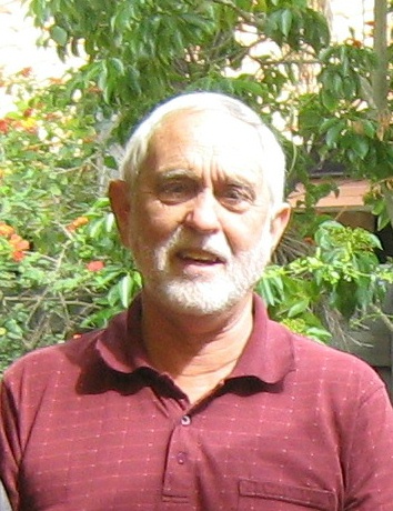
David Groves was born in Brighton, England, and migrated to Tasmania where he was educated at Hobart High School and at the University of Tasmania, completing a PhD under the mentorship of Mike Solomon. After a period with the Geological Survey of Tasmania, David was appointed Lecturer in Economic Geology at the University of Western Australia (UWA) in 1972. In 1987, he was awarded a Personal Chair at UWA and formed the Centre for Strategic Mineral Deposits, which morphed into the Centre for Global Metallogeny, with him as Director, and which became the Centre for Exploration Targeting after his retirement as Emeritus Professor. He had a very successful academic career in terms of highly-cited published papers and book chapters, keynote and invited lectures, and mentorship of many outstanding postgraduates, being awarded 12 medals and prizes, including the SEG Silver and Penrose Gold Medals and the SGA-Newmont Gold Medal, and being inducted into the Australian Academy of Sciences as a Fellow. Since his retirement from UWA, David has continued to write papers and mentor staff and students at the China University of Geosciences in Beijing (CUGB), as well as consult to industry, being involved in discovery of two > 1Moz gold deposits during greenfield exploration in Tanzania and Ethiopia.

In 2018, he was made a National Geoscience Champion by the Australian Geoscience Council and recognized as one of the 125 Faces of Geoscience by the Australasian Institute of Mining and Metallurgy. In recent years, David has also published three novels, with “The Plagues’ Protocol” having a “geological detective” as the main left-field thinking character. He has also commenced writing novels for a Chinese audience, the first in press being “Destiny on Magic White Mountain”, again with a strong mineral exploration background. He hopes to help popularize geology through his novels as part of his role as National Geoscience Champion.


Pages