Membership renewals open for 2024 - Click here
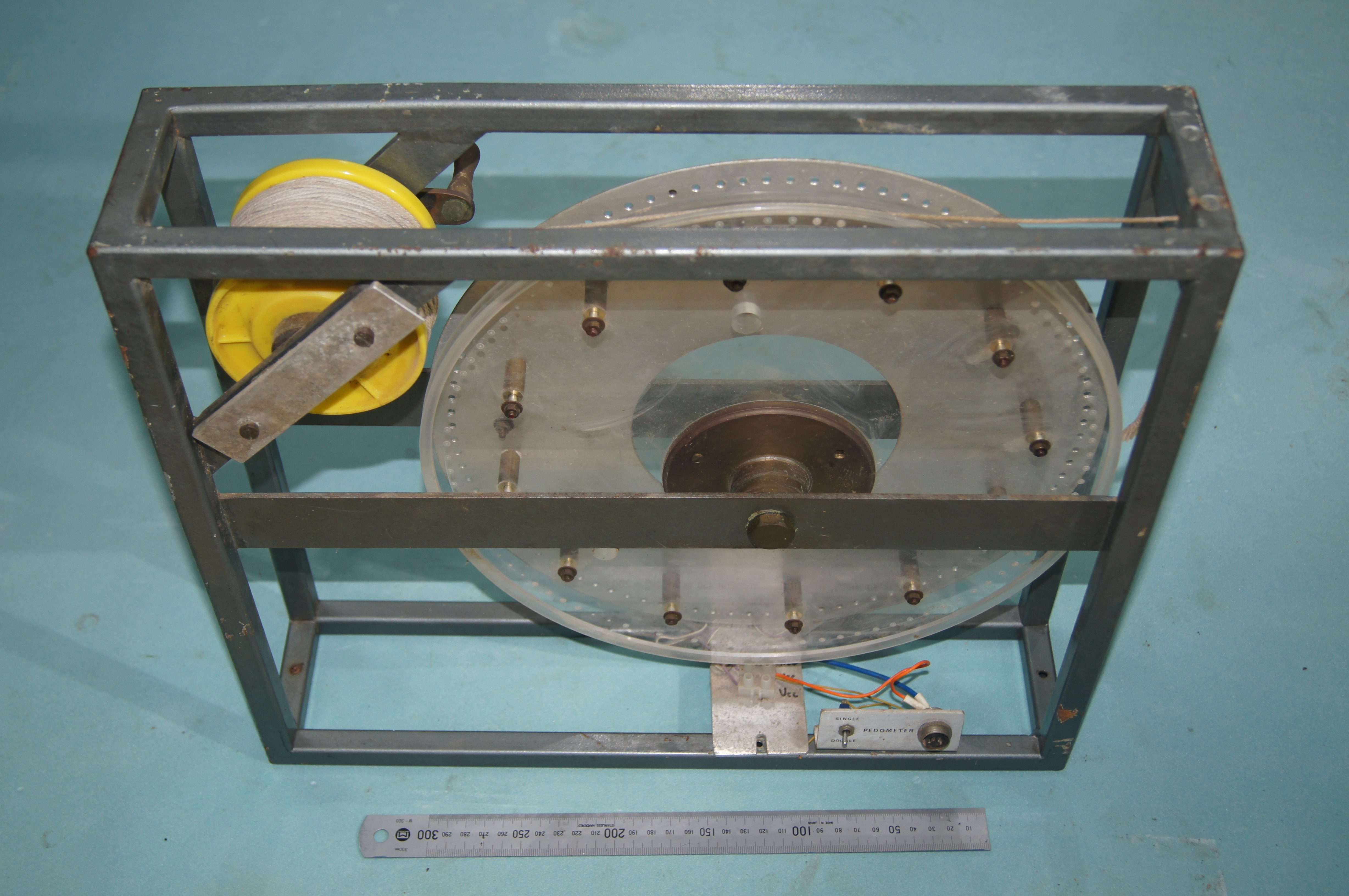
Archaeological Survey Odometer
University of New England. Armidale, Australia
1973
Method: Survey planning
Description
The development of a magnetometer capable of outputting magnetic field measurements to 1 nT resolution as fast as at 45 Hz or 0.1 nT five times per second demanded technology for automatically recording such measurements together with the measured position of such data on a survey grid covering the area to be mapped. Archaeological site mapping was an attractive application. The Cs magnetometer sensor was able to be operated from a cable up to 30 m from the control electronics. So a stepper motor was fitted to a chart recorder and this was interfaced to the magnetometer controller’s analogue output. An odometer was required to produce trigger pulses to step the chart recorder motor and provide a scalable record proportional to the distance traversed along a grid line of typically 25 m length. The odometer exhibited, enabled the sensor carrier to pull a string line wound over an optically coupled wheel which delivered trigger pulses every 10 mm traversed. At the end of an out-bound survey line, the sensor carrier would move typically 200 mm across grid, and the recorder operator would “wind the string back” as the return grid line was mapped. With this system a 25 x 25 m area could be mapped to 0.1 nT resolution with a grid mesh of 200 x 200 mm in under four hours. An analogue form of “image processing” was then devised whereby the analogue records were traced and stacked from the near side of the grid to the back with a scaled offset and hidden line where concealed by a foreground feature. The result was a 3-dimensional, “isometric” plot of the magnetic field surface.
Comparing the use of this system with the prior state-of-the-art, the Elsec proton precession magnetometer, the magnetic resolution was improved by a factor of 10. But of greater significance in practice was the fact that the same data set would have required 43 hours to acquire using the Elsec and the 19,530 data measurements acquired would then have to be either plotted by hand or typed onto punch cards for input to a mainframe computer. High definition magnetic mapping at an archaeological scale had now become viable.
Measures linear distance along grid survey lines.
Resolution: 10 mm
Serial Number: 1
Year of manufacture: 1973
Origin: University of New England. Armidale, Australia