Membership renewals open for 2024 - Click here
Event Address
Webinar
Event Start
1800 (AEST)
Event End
1900 (AEST)
Event Details
Brought to you by NSW on Wednesday 21 October, 6pm (AEST) for a talk by Peter Hatherly.
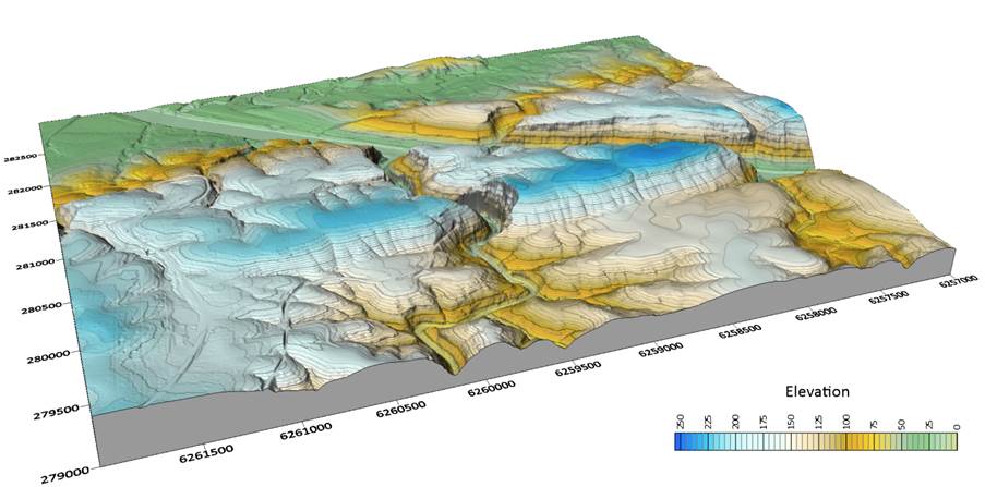
Stranded stream channels investigated by LiDAR mapping, some geophysics and good old leg work. Insights into the Lapstone Structural Complex west of Sydney.
In the contemporary parlance, the western boundary of what the media call the Sydney Basin is the Lapstone Structural Complex. The front range of the Blue Mountains. This abrupt escarpment rises to a maximum height of 600 m above the Cumberland Plain and forms an impressive boundary to the Blue Mountains beyond.
Geologists identified the monoclines and faults associated with the LSC as early as the nineteenth century but an understanding of the exact nature of the structure and its timing is still not clear. In this talk I take note of evidence of stranded channels evident in detailed LiDAR mapping, the occurrence of river gravels now high above the Nepean River and seismic refraction results within the Thirlmere Lakes, a curious river system within the southern extension of the LSC.
My suggestion is that in its present form, the LSC is probably no older than 10 million years.
Register now: https://us02web.zoom.us/webinar/register/WN_klquuUL_Q3a39DbZUM-9rQ